
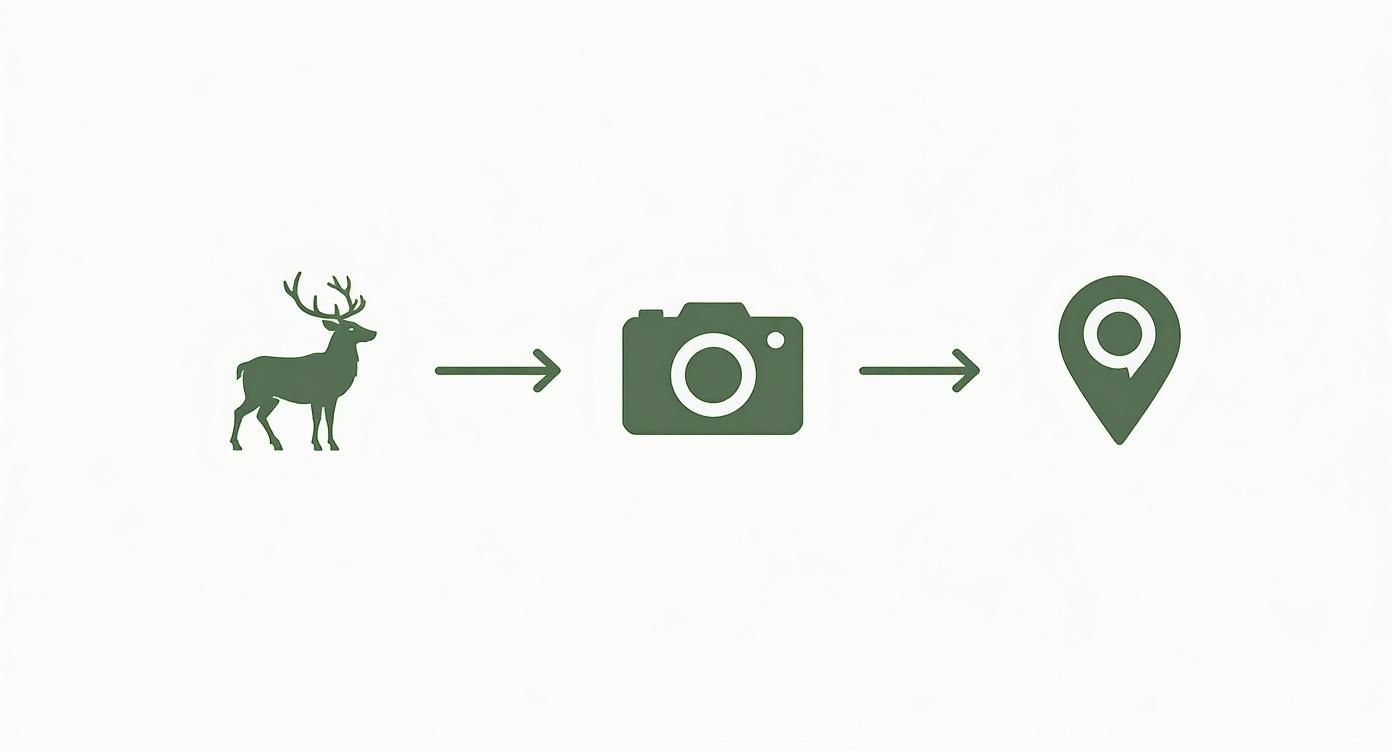
Think of a modern trail camera with GPS tracking as giving your eyes in the woods a homing beacon. It’s a standard motion-activated camera, but with a crucial upgrade: a built-in GPS that pinpoints its exact location at all times. This single feature is a game-changer for mapping animal activity and recovering stolen gear.
Understanding the Value of GPS Integration
At its core, a trail camera is a simple tool. It sits there, waits for movement, and snaps a picture. For years, that was more than enough for most of us.
But as hunters, researchers, and land managers started deploying dozens of cameras across vast and often confusing terrain, a new headache emerged. Trying to remember the precise location of twelve different cameras scattered across 500 acres can turn into a logistical nightmare. This is where a trail camera with GPS tracking changes the game.
It moves beyond just capturing what’s happening to also record precisely where it’s happening. It’s less of a camera and more of a powerful data collection device, solving two huge problems at once: mapping and security.
Mapping Wildlife with Precision
Instead of relying on a shaky memory or handwritten notes scribbled on a map, GPS integration automates your entire scouting network. Every photo or video file is automatically stamped with geographic coordinates—a process called geotagging.
Suddenly, you have an incredibly detailed and accurate map of wildlife activity on your property.
- For Hunters: You can see instantly which food plots are getting hammered, identify the exact travel corridors between bedding and feeding areas, and pinpoint where that trophy buck showed up last Tuesday.
- For Researchers: This feature is all about data integrity. Scientists can map species distribution, track migration patterns, and monitor specific territories with scientific accuracy.
By stamping every image with a location, a GPS-enabled camera transforms a random collection of photos into a strategic, actionable map of your environment. It's the difference between guessing where the action is and knowing for certain.
Securing Your Investment
Let's be honest—trail cameras aren't cheap. They’re valuable pieces of equipment often left unattended in the middle of nowhere for weeks or months, making them a tempting target for thieves.
A camera with GPS tracking acts as its own security guard. If the camera is moved or stolen, it can transmit its new location right to your smartphone, massively increasing your chances of getting it back. It’s the kind of peace of mind that protects your investment while it works for you.
The demand for these smarter cameras is exploding. The global trail camera market was valued at USD 101.7 million in 2022 and is expected to hit USD 175.1 million by 2030, largely driven by the boom in outdoor recreation. You can see the market growth analysis on Fortune Business Insights. This trend makes one thing clear: people are moving toward smarter, more connected devices that do more than just take a picture.
How GPS Functionality Transforms Your Camera
A trail camera with GPS tracking does a whole lot more than just tell you where your gear is. It completely changes how you scout, manage property, and understand the wildlife that moves through it. To really get it, you need to look past the general idea of "GPS" and break it down into the two jobs it performs: geotagging and live location tracking.
Think of them as a team. One is the field scientist, meticulously stamping every photo with precise coordinates. The other is the security guard, keeping a constant, watchful eye on your valuable camera. Working together, they turn a simple camera into a powerful intelligence-gathering tool that feeds info straight to your phone.
The Power of Precise Geotagging
At its core, geotagging is simple. The GPS chip inside your camera is always talking to satellites. The moment the sensor trips and the camera takes a picture, the GPS grabs the exact latitude and longitude and bakes that data right into the image file.
The best part? It’s completely automatic—you just have to turn the feature on. This means every photo you get isn't just an image; it's a specific, verifiable data point you can see on a map.
A geotagged photo answers two crucial questions at once: what was there and exactly where it was. This elevates a simple picture into a piece of strategic intelligence you can use to map buck travel corridors or monitor fence lines.
Real-Time Security with Live Location Tracking
While geotagging pinpoints the location of the photo, live location tracking is all about the location of the camera itself. This is the feature that turns your camera into a trackable asset, just like using the "Find My" app on your iPhone.
The camera’s GPS module periodically sends out a "ping" with its location over the cellular network, updating your app.
- Standard Check-ins: Most cameras will report their location at set intervals, like once every 12 or 24 hours, just to confirm they’re safe and sound.
- On-Demand Pings: Many apps let you manually request the camera's current location for an instant update.
- Theft Alerts: This is the big one. If the camera is moved when it shouldn’t be, some models will instantly alert you and start tracking its location more frequently, giving you a real shot at getting it back.
The entire process, from a buck walking past the lens to you seeing his exact location on your property map, is a seamless flow of data.
This journey—from a real-world event to a strategic dot on your digital map—is what makes this technology so powerful for hunters and land managers.
To make it even clearer, let's break down these two core functions side-by-side.
Core GPS Functions Explained
| GPS Function | How It Works | Primary Benefit |
|---|---|---|
| Geotagging | Embeds latitude and longitude coordinates directly into the image file the moment a photo is taken. | Mapping Wildlife Activity: Tells you exactly where an animal was, helping you pattern movement and identify key areas like scrapes, trails, and bedding zones. |
| Live Location Tracking | Periodically sends the camera's physical coordinates to your app via the cellular network. | Asset Protection & Recovery: Lets you find your camera if it’s stolen or you simply forget where you placed it on a large property. |
These two features work hand-in-hand to give you a complete picture of what's happening on your land and where your equipment is at all times.
How GPS and Cellular Work Together
It’s absolutely critical to understand that GPS and cellular are partners, but they do different jobs. The GPS receiver listens to satellites to figure out where it is. But it needs the cellular modem to tell you that location.
Without a cell signal, a GPS camera can still geotag the photos it saves to the SD card. But it can’t send you real-time location pings, theft alerts, or the photos themselves.
This partnership is what makes a trail camera with GPS tracking so effective. The GPS provides the "where," and the cellular network provides the "now." That synergy unlocks a level of control and insight that was impossible just a few years ago, whether you're running a single camera on a 40-acre lease or managing dozens across a remote ranch.
Putting Your GPS Trail Camera to Work
Knowing the tech behind a trail camera with GPS tracking is one thing. Seeing it in action is another story entirely. This isn't about features on a box; it's about solving real problems for people who need solid information from the field.
Whether you're a hunter trying to pattern a whitetail, a biologist studying migration, or a landowner trying to keep your property secure, the practical uses are what make this gear a game-changer. It’s about turning raw location data into a real strategic advantage.
Let's dig into how people are putting this technology to work every single day.
For the Hunter Creating a Buck Map
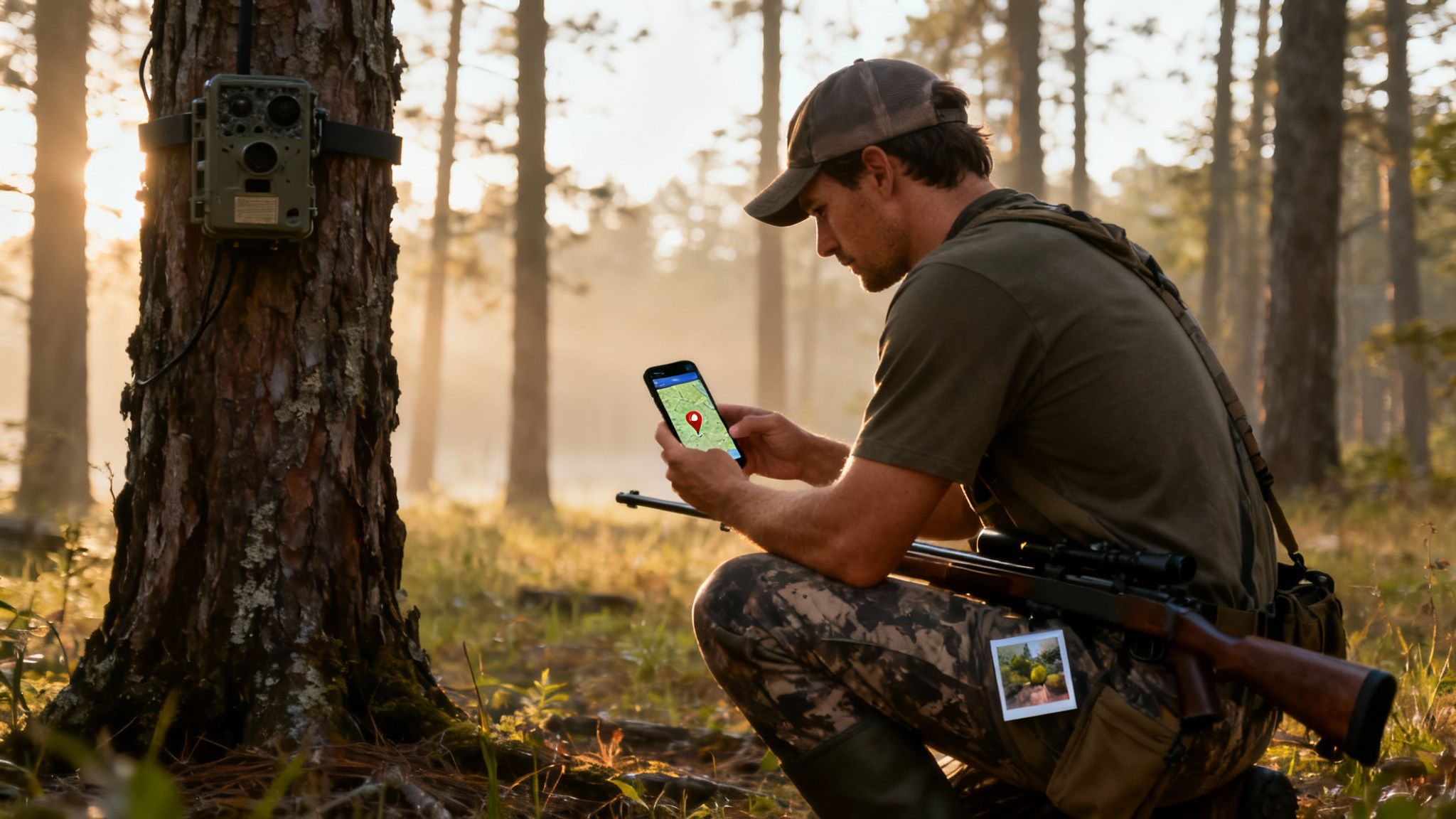
For any serious hunter, a trail camera with GPS tracking is the best scouting partner you could ask for. It completely automates the old, tedious job of building a "buck map"—a detailed layout of where specific deer are moving across your property.
Forget scribbling notes in the rain or trying to remember which of your ten cameras caught that big eight-pointer. The camera and app do all the heavy lifting.
Here’s how it works in the real world:
- Smart Placement: You hang cameras along what you think are travel corridors, food plots, and over scrapes. Each camera’s location is automatically logged in your app the second you turn it on.
- Automatic Geotagging: Every time a deer trips the sensor, the photo gets sent to your phone with its exact GPS coordinates baked right into the file.
- Seeing the Pattern: Your app takes those geotagged photos and plots them on a satellite map. After a few weeks, a crystal-clear pattern starts to show up, revealing exactly where your target buck is hanging out and when.
Suddenly, you can see which stand gives you the best odds based on wind direction and time of day. You’re moving from guesswork to a data-driven plan, which makes every hour you spend in the woods that much more effective.
For the Wildlife Researcher Ensuring Data Accuracy
In wildlife research, data integrity is everything. One misplaced pin on a map can throw off an entire study. A trail camera with GPS tracking delivers the kind of verifiable, accurate location data that researchers absolutely depend on to draw sound conclusions.
Imagine a biologist tracking a bobcat population. By setting up a grid of GPS-enabled cameras, they can:
- Map Home Ranges: Every photo of a specific bobcat is a precise data point, letting them accurately map the boundaries of its territory.
- Track Migration Corridors: Over time, these geotagged sightings show seasonal movements and the critical paths animals use to get around.
- Guarantee Repeatable Studies: Having exact coordinates means other scientists can replicate the study or confidently build on the existing data down the road.
For scientific work, GPS isn't just a nice-to-have feature—it's a must. It provides the hard, location-based evidence needed for credible research on animal distribution, behavior, and habitat.
This level of precision is vital for conservation, helping us identify and protect the specific areas wildlife needs to survive.
For the Landowner Protecting Property
If you manage a large piece of land, a GPS trail camera gives you a powerful mix of security and property management. It becomes your eyes on the ground, watching remote fence lines, gates, and equipment sheds around the clock.
The live tracking is where it really shines as an anti-theft tool. If a camera watching over a tractor or ATV gets stolen, its GPS sends you an immediate alert. You can track its location in real-time, giving law enforcement the exact info they need to get it back. Just like that, a passive monitor becomes an active security system.
The market for cellular cameras with these features is exploding, with a projected value of USD 1.525 billion by 2033. That growth is happening because people see their value for both wildlife scouting and boots-on-the-ground security—from stopping poachers to helping ranchers protect livestock. You can dive into the full market analysis of hunting camera technologies to see how these uses are driving demand.
By combining geotagged images with live tracking, landowners can effectively monitor for trespassing, shut down theft, and get some peace of mind.
How to Choose the Right GPS Trail Camera
Picking the right trail camera with GPS tracking can feel like a chore, but if you focus on what really matters out in the woods, you’ll find the perfect fit. This isn't just about comparing megapixels on a spec sheet; it's about matching the camera's real-world skills to your specific needs, whether you're managing a hundred-acre lease or a remote research plot.
Think of it like buying a good pair of boots. The best ones aren't just tough—they’re built for the exact terrain you'll be walking. Your ideal camera should blend reliable tech, a practical design, and a user experience that doesn't get in your way.
Evaluate Core GPS and Cellular Performance
The two big-ticket items are GPS and cellular connectivity, so let's start there. Not all systems are created equal, and you'll find that performance can swing wildly depending on your location and the camera's hardware.
First up is GPS accuracy. How tight is that location data? You want a model known for grabbing a satellite signal quickly and holding it, especially under a thick tree canopy where signals get weak. A camera that pins a location within a few feet is a game-changer for mapping a scrape line. One with a 50-foot margin of error? Not so much.
Next, dig into cellular network compatibility. Is the camera locked into one carrier, or can it play nice with AT&T, Verizon, and T-Mobile? Many modern cameras, like our all-in-one 4G Magic Eagle® EagleCam 5, automatically find and switch to the strongest signal in the area. That’s a massive advantage in backcountry spots with sketchy service. Before you buy anything, pull up the coverage maps for your hunting or research area to make sure the camera will stay online.
Battery Life and Power Options
A camera loaded with incredible features is just a plastic box if its batteries are dead. The GPS and cellular modem are the two biggest power hogs, creating a constant tug-of-war between performance and longevity.
A camera's battery life is a direct result of how often its GPS and cellular functions are working. Frequent photo transmissions and live location "pings" will drain batteries significantly faster than a more conservative setup.
Look for a camera that gives you flexible power settings and options:
- Adjustable Check-Ins: Can you tell the camera how often to report its location? Setting it to check in just once every 24 hours will save a ton of power compared to an hourly ping.
- External Power Support: A port for a solar panel or an external battery pack is a must-have for long-term deployments. It can keep a camera running for months without you having to trek back in.
- Efficient Operation: Check user reviews and independent tests to see how a model actually performs in the field. Some cameras are just built smarter to conserve energy while they work.
App Usability and Software Features
The camera itself is only half the story. You'll be interacting with your trail camera with GPS tracking almost entirely through its mobile app, and a clunky, confusing interface can sour the whole experience.
A great app should deliver:
- An Interactive Map: Seeing all your camera locations, geotagged photos, and even your own pins for stands or food plots on a single satellite map is essential.
- Intuitive Controls: Setting up the camera, tweaking the GPS ping frequency, and sorting photos should be simple and quick. No one wants to fight with their tech.
- Reliable Alerts: You need timely and customizable notifications for new photos or security alerts. This is non-negotiable.
The demand for these connected cameras is exploding. The global trail camera market, which includes GPS models, was valued at USD 852.97 million in 2024 and is expected to hit USD 1,420.95 million by 2032. That growth is being fueled by users who want smarter, app-based tools for everything from hunting in North America to watching over crops in the Asia-Pacific. You can explore more market projections on 360iResearch.com. This trend just highlights how critical a polished software experience has become.
Durability and Physical Design
Finally, the camera has to be tough enough to survive the outdoors. It’s going to get blasted by rain, snow, heat, and probably chewed on by a curious bear or raccoon.
Look for a high IP (Ingress Protection) rating—something like IP66 or better—which proves it’s sealed tight against dust and heavy rain. The case itself should feel rugged, with a strong latching system. And don't forget the camouflage pattern; a camera that melts into its surroundings is far less likely to be spotted by wildlife or two-legged thieves.
Field Setup for Peak GPS Performance
Getting your hands on a new trail camera with GPS tracking is the easy part. The real magic happens when you set it up correctly in the field. Proper placement is everything—it ensures you get a strong GPS and cell signal, makes your battery last, and helps you start collecting useful data from day one.
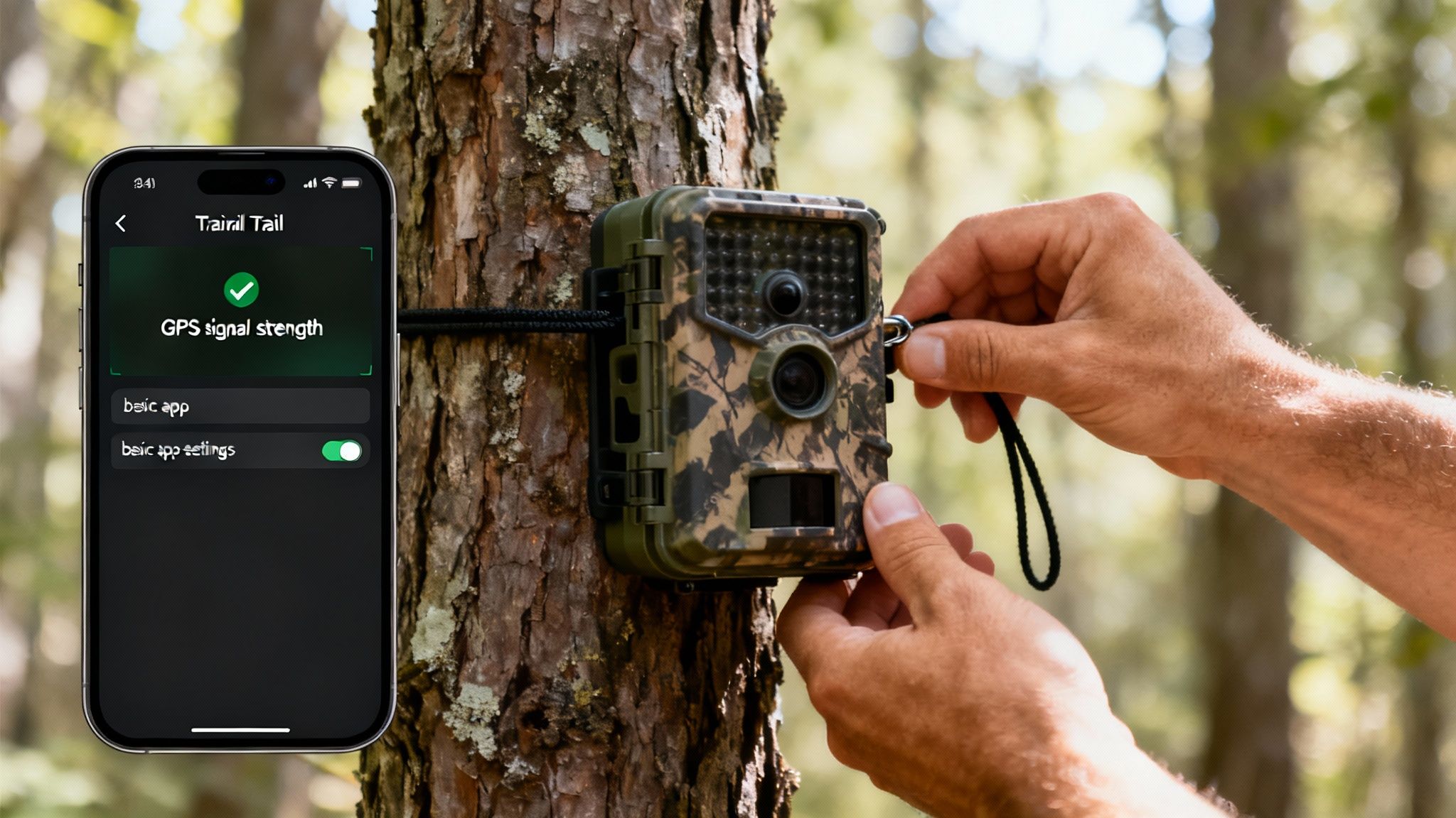
Think of it this way: you wouldn't build a house on a shaky foundation. The same goes for your camera. Get everything activated and configured at home before you head out. Trust me, it’s a lot easier to troubleshoot with a good Wi-Fi connection than it is in the middle of the woods.
The very first step is to get the cellular plan running. Most modern cameras, including the Magic Eagle lineup, ship with a SIM card that’s ready to go and can connect to multiple networks. You'll usually activate it through the brand's app or website by setting up an account and picking a data plan that makes sense for you.
Initial Configuration in the App
With the camera powered on and the plan active, it's time to open up the mobile app. This is your command center, where you'll tell the camera exactly how to operate while balancing performance and power.
Your first move should be to turn on all the GPS features. This is usually a simple toggle in the settings for geotagging photos and enabling the live location tracking (often called "Find My Camera"). This makes sure every photo and every check-in is pinned to a precise spot on your map. For a full rundown of the basics, our guide on how to set up a trail camera is a great resource.
Next, you need to decide on the GPS check-in frequency. This setting is the biggest factor in how long your batteries will last.
- High-Frequency Tracking (e.g., every hour): This gives you almost real-time location pings, which is perfect for high-theft areas. The trade-off? It’s a serious battery hog.
- Standard Tracking (e.g., every 12-24 hours): This is the sweet spot for most of us. It confirms your camera hasn’t moved once or twice a day, giving you peace of mind without killing the battery.
- On-Demand Only: Some cameras let you turn off automatic check-ins and only ping the location when you request it. This saves the most power but offers less proactive security.
Maximizing Signal Strength in the Field
When you’re finally at your spot, where you mount the camera is critical. GPS and cellular signals are just radio waves, and they get blocked by stuff—trees, hills, you name it. Your camera needs a clear line of sight to the sky to talk to the satellites.
A camera stuck at the bottom of a deep ravine or under a thick blanket of pine trees is going to struggle. The terrain itself acts like a giant wall, blocking those faint signals from space.
Try to find a spot with at least a partial opening overhead. Mounting your camera on the side of a tree facing a clearing or a logging road can make a world of difference. Getting it a little higher up—around 6 to 8 feet—also helps pull in a better signal and keeps it out of sight from people walking by.
Ethical and Legal Placement Considerations
Finally, using a powerful tool like a trail camera with GPS tracking comes with responsibilities. Being a good steward of the land means following the rules and respecting others.
- Know the Law: Always check your local and state regulations. Some public lands have strict rules about when and where cameras can be placed, especially during hunting seasons.
- Respect Private Property: This one’s a no-brainer. Never put a camera on land you don’t own without getting clear permission first. GPS data doesn’t lie, and it’s an easy way to prove you were trespassing.
- Avoid Private Spaces: Keep your cameras pointed away from trails, roads, or neighboring properties. The goal is to monitor wildlife or your land, not to spy on people.
Common Questions About GPS Trail Cameras
As you get closer to picking out the right trail camera with GPS tracking, it’s only natural to have a few last-minute questions. This tech is a big leap from standard cameras, so getting the practical details on costs, how it all works, and any limitations will help you feel confident in your choice.
Let's clear the air and tackle some of the most common questions head-on.
Do All Cellular Trail Cameras Have GPS Tracking?
This is where a lot of people get tripped up. The short answer is no, not all cellular cameras include GPS tracking. While the two features often come bundled in modern, higher-end models, having a cellular connection doesn't automatically mean it has GPS.
Think of it this way: cellular is for sending data—the photos and videos—to your phone. GPS is a totally separate piece of hardware, a specific module inside the camera that figures out its physical location. Plenty of basic or older cellular models were built just to send images and don't have the internal chip needed for geotagging or live tracking.
When you're shopping, you need to see "GPS Tracking," "Geotagging," or "Anti-Theft Tracking" listed as an actual feature. Never assume a cellular camera has it.
How Much Data Does a GPS Trail Camera Use?
Surprisingly, the GPS function itself uses a tiny, almost unnoticeable amount of data. Sending location coordinates is like sending a quick text message; it's just a small packet of information. The real data hogs are the photos and videos the camera is capturing and sending you.
Here's a simple breakdown:
- GPS Data: A single location ping is just a few kilobytes. It's practically nothing.
- Photo Data: A standard-resolution photo might run you 100-300 kilobytes.
- Video Data: A short video clip can easily be several megabytes, using 10-20 times more data than a single photo.
This is why most cellular data plans for trail cameras are built around how many photos or videos you want to get, not how many GPS pings it sends. The location tracking is usually just a bonus feature that piggybacks on the image data.
Can a GPS Trail Camera Work Without a Cellular Signal?
This is a "yes and no" situation. It all boils down to which GPS feature you're talking about. A trail camera with GPS tracking actually needs both satellite and cellular signals, but they do completely different jobs.
The GPS receiver can "see" satellites and pinpoint its location without any cell service at all. That means it can still do geotagging—embedding the coordinates into every single photo it saves to the SD card. You could pull the card later, pop it into your computer, and see exactly where each photo was taken.
But for any real-time feature, a cellular signal is non-negotiable. Without a network connection, the camera can't:
- Send photos or videos to your app.
- Transmit its live location for anti-theft tracking.
- Respond when you ping it for an on-demand location update.
If your camera is in a service dead zone, it'll still be snapping pictures and geotagging them locally, but it can't talk to you until it finds a signal again.
The camera’s GPS can figure out where it is on its own, but it needs a cellular connection to tell you where it is. One function works offline, while the other absolutely requires a network.
Are There Extra Fees for the GPS Tracking Feature?
Typically, you won't find a separate line item on your bill for a "GPS Fee." The cost for the GPS hardware is just baked into the initial price of the camera itself.
Your main ongoing cost is the cellular data plan, which you need for any remote communication—that includes both sending photos and live location tracking. This is usually a monthly or annual subscription. You can get a better feel for how these plans work by reading our guide on using a cellular trail camera without a data plan to understand why an active plan is so important for remote features.
Just be aware that some brands might lock advanced mapping or security features, like geofencing alerts, behind their premium subscription tiers. Always check the fine print on the data plans to see exactly what’s included at each price point before you commit.
Ready to gain complete control over your scouting and security? The Magic Eagle EagleCam 5 offers robust GPS tracking, AI-powered species recognition, and SignalSync technology to keep you connected in the field.
Shop the EagleCam 5 and transform your property management at magiceagle.com